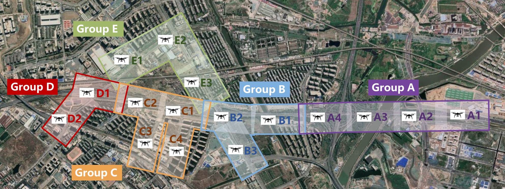
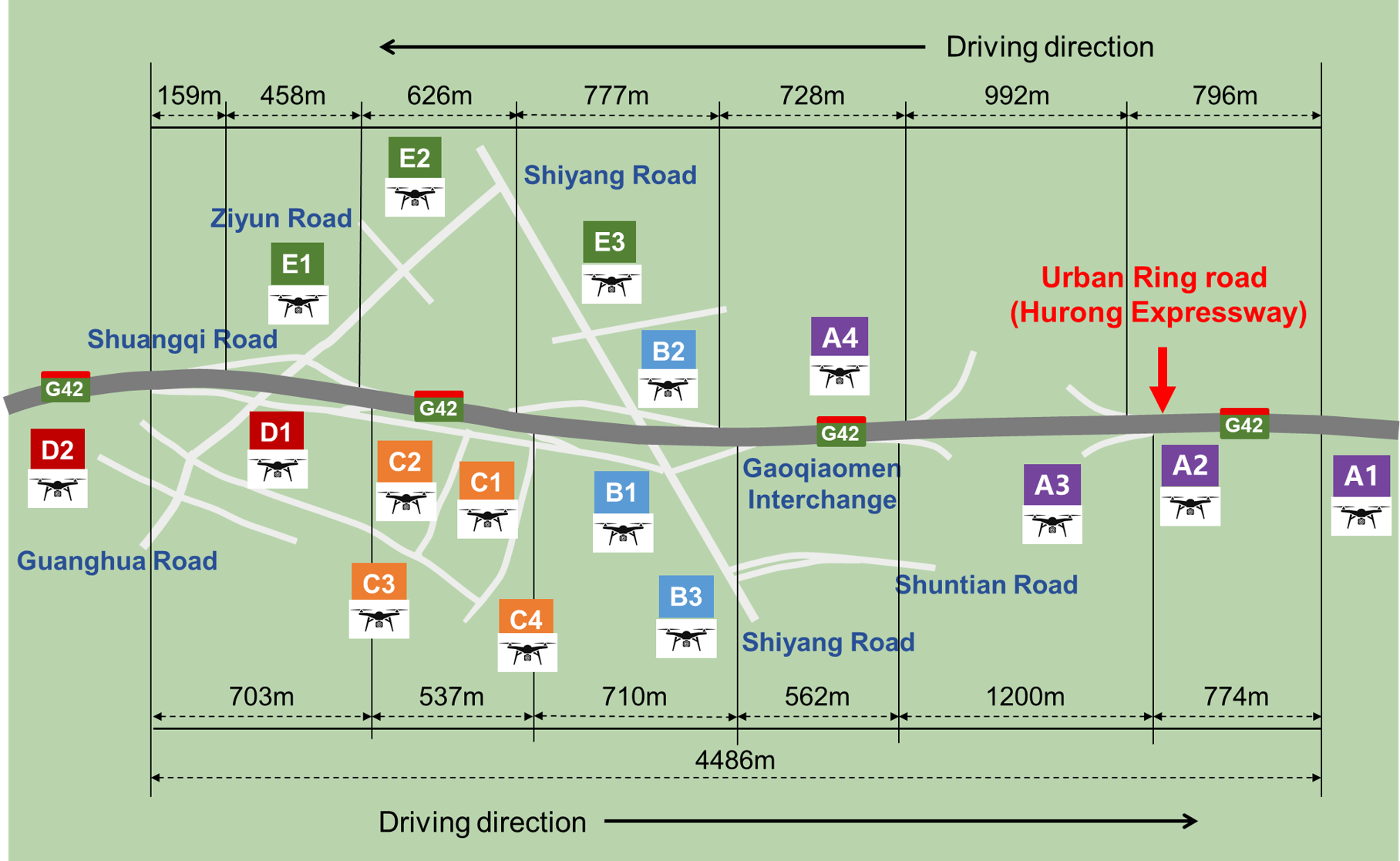
Swarm Intelligence Freeway–Urban Trajectories (SWIFTraj) Dataset

SwiftTraj is an open source, drone based vehicle trajectory dataset that provides large scale, continuous, and high resolution trajectories across both freeway and urban networks, enabling comprehensive analysis of traffic phenomena, driver behavior, and intelligent vehicle applications.

Trajectory heatmap

Data Summary

16 Drones

Summary 1

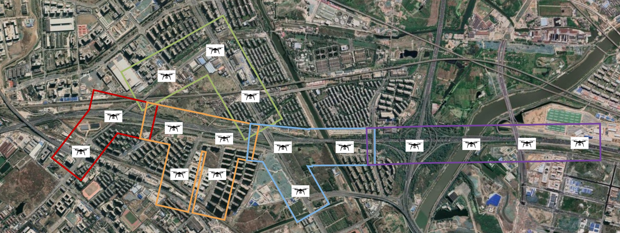
Simultaneously hovering over multiple freeway sections to provide continuous coverage.
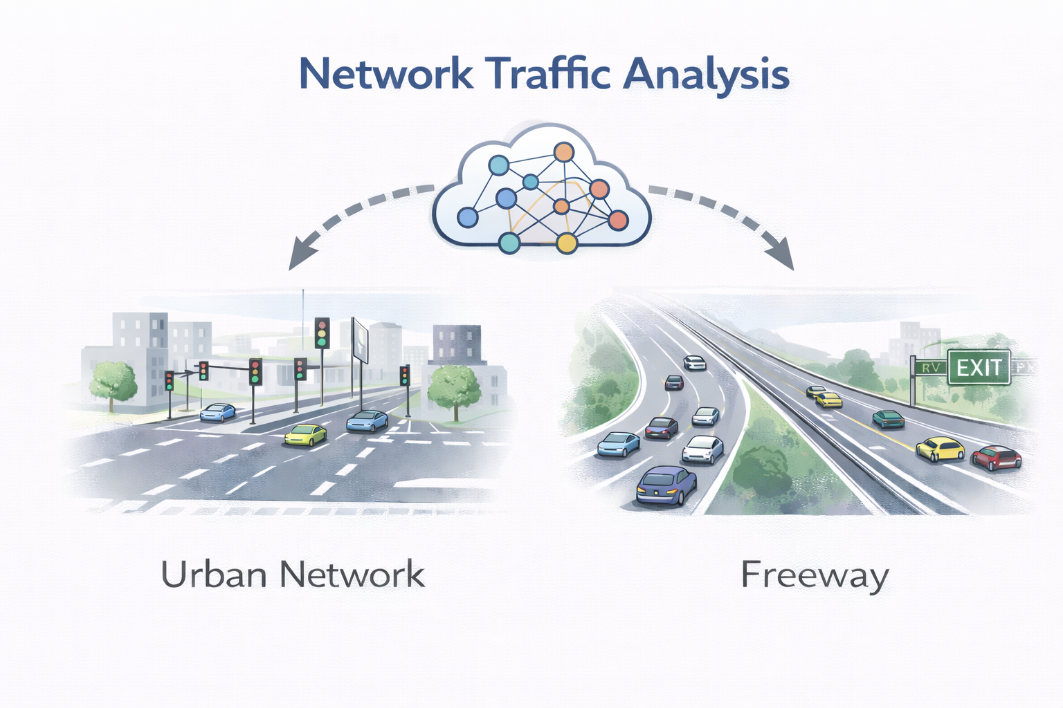
Hybrid Network

Summary 2

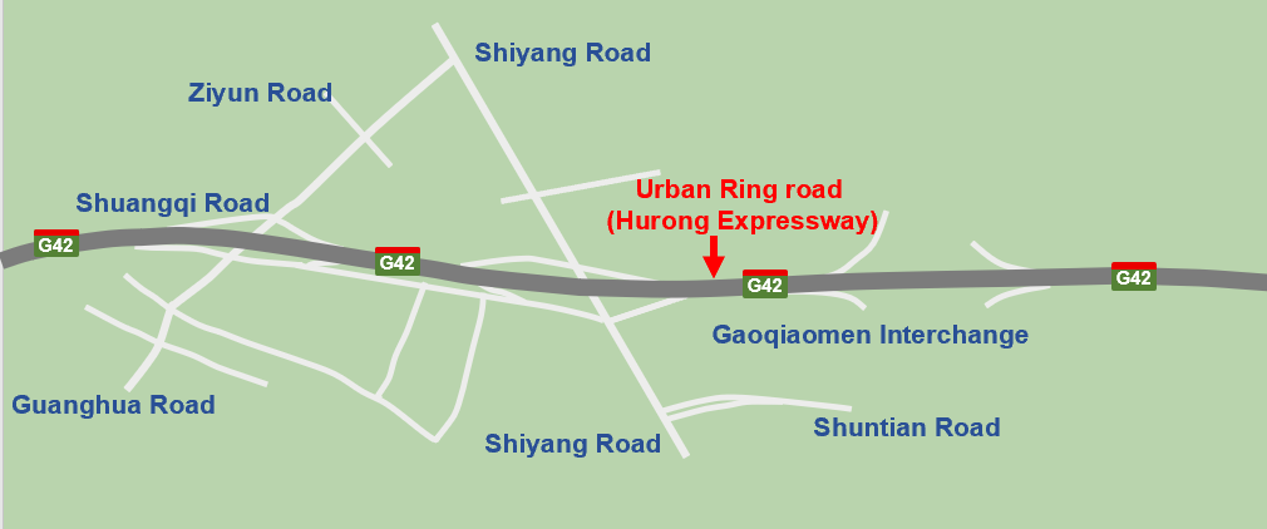
A long freeway corridor together with its connected urban road network.

4.5 km Coverage

Summary 3

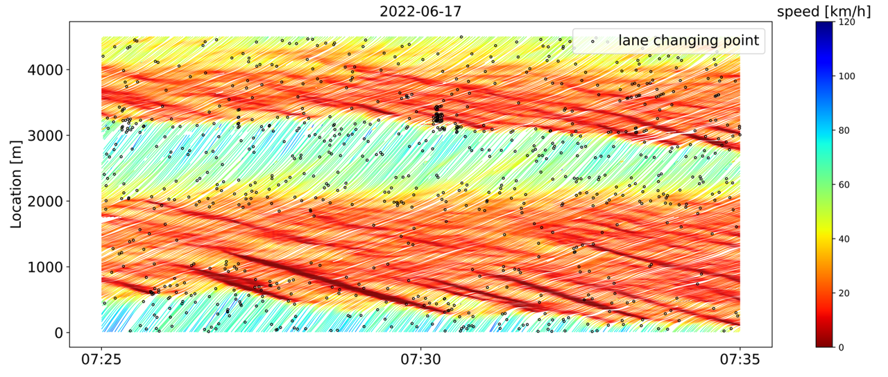
Continuous vehicle trajectories along a 4.5 km freeway corridor.

Multiple Bottlenecks

Summary 4

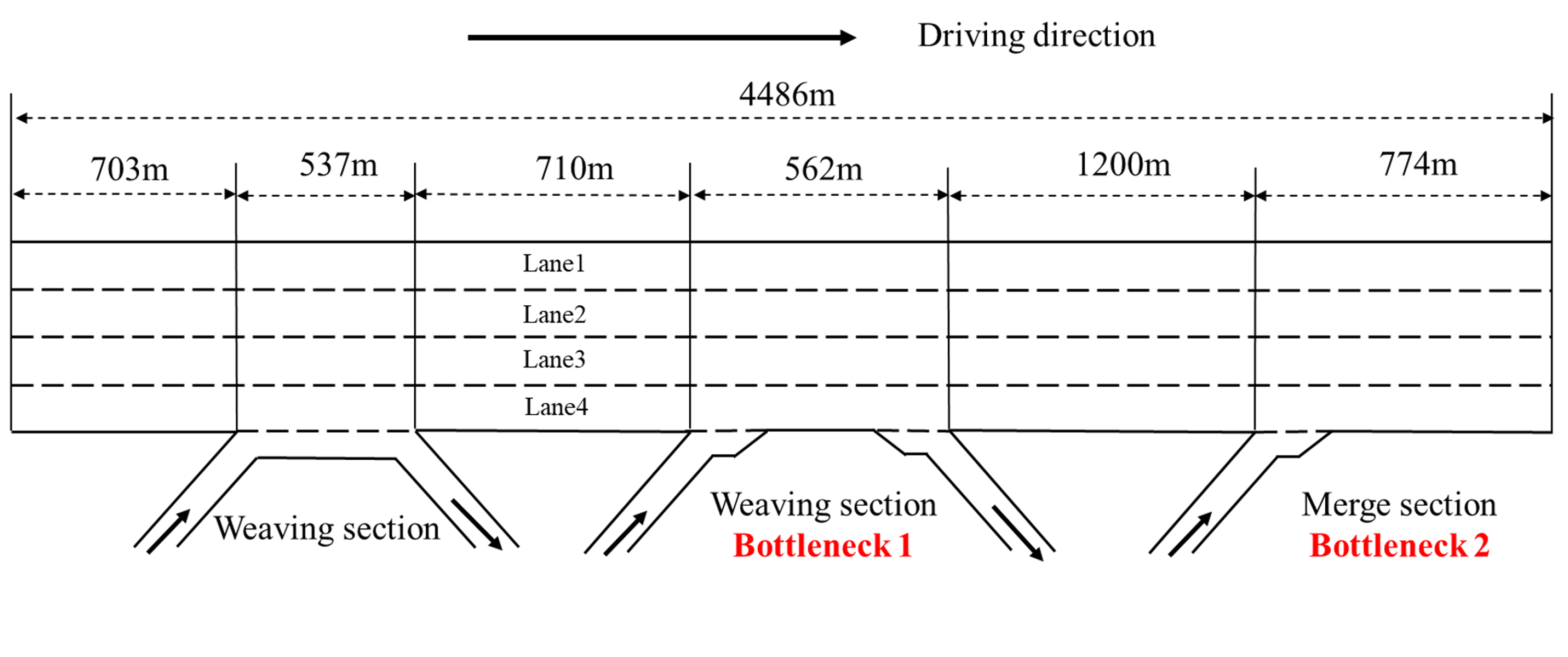
Consecutive bottlenecks along the corridor, including weaving and merge bottlenecks.

Experiment Details

Loading experiment details...
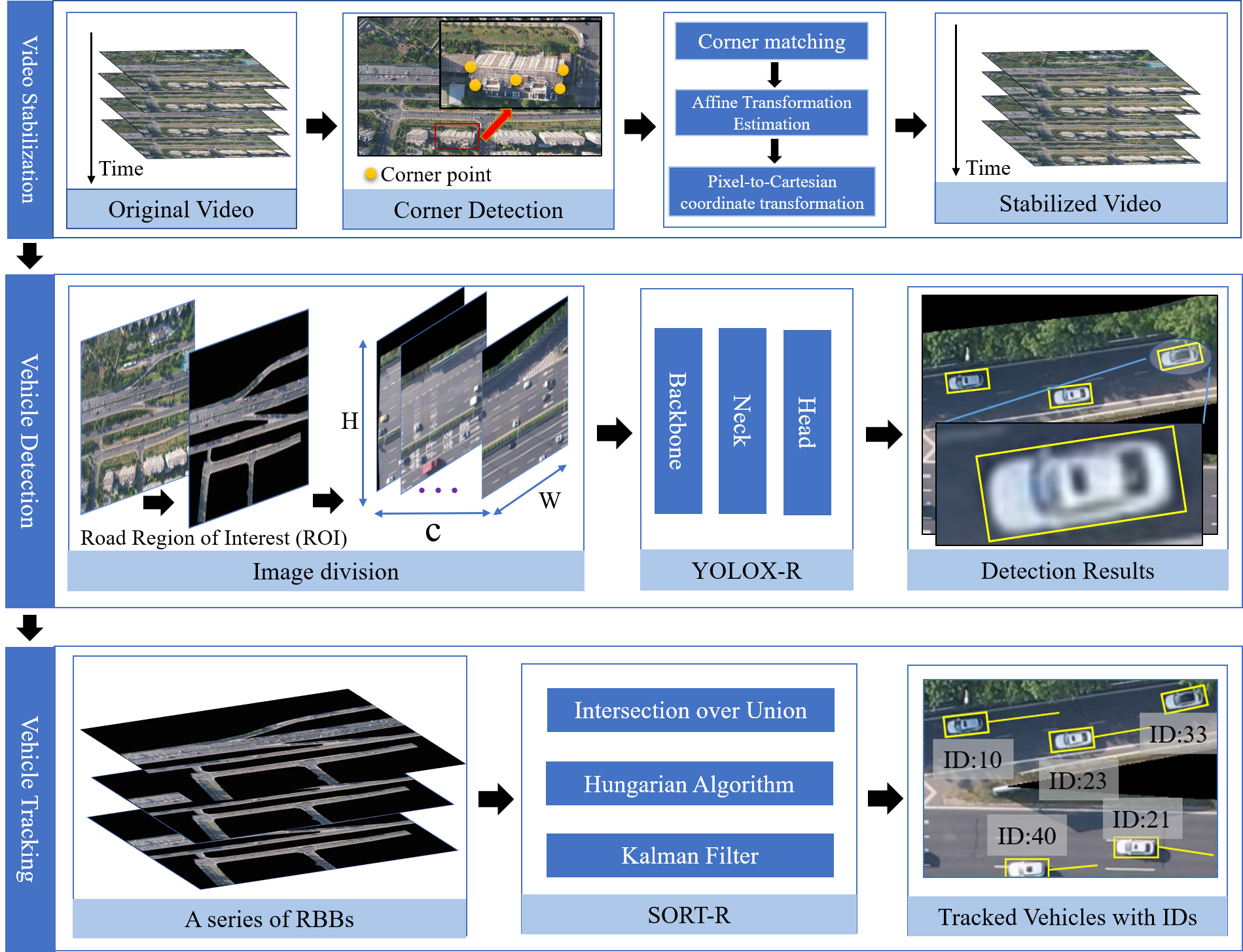
Experiment Setup
Drone deployment locations shown on the satellite map
Experiment Setup
Drone deployment locations shown on the topological map

Data Processing

Loading processing details...

Data Processing Pipeline
Overview of the UAV-based vehicle trajectory extraction pipeline
Data Processing Pipeline
Overview of the multi-UAV trajectory stitching pipeline

Data usage for research possibilities

Usage 1
Usage 2
Usage 3
Usage 4
|